Mount Whitney 2012
Location:
Inyo National forest California
Elevation:
14,505ft
Whitney is the highest summit in the contiguous United States.
So I have always wanted to climb Mount Whitney and this summer I was lucky enough to get a permit. The permits are setup on a lottery system that only allow 100 people a day. The hardest part about the permits is determining which permit you need. Talk about a huge pain in the ass. After a week or two of hoops I was finally granted a slot in June. We made accommodation to stay in Lone Pine, Ca and headed down Friday morning. Its about a 9 hour drive from Boise with nothing but desert to keep you company, exciting! We stopped in Bishop for some dinner and then called it a night around 12am.
We woke up around 6:30 and got to the trail head around 7ish. The trail head parking lot was surprisingly empty for such a popular climb. There are a couple different routes on Whitney that the masses do. We chose to do the Mountaineers route on the ascent and come down the Main Whitney trail. The Mountaineers route is less crowded and more technical (Class III).
 |
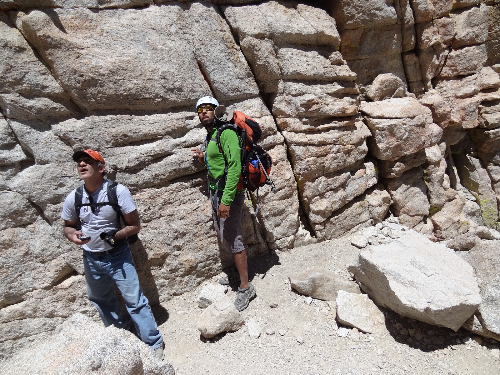
| Ebersbacher Ledges |
Our first stop on the Ebersbacher Ledges. If you look down the canyon you can see the road / trail head.
We arrived at Lower Boy Scout Lake.
I thought this water feature might be good ice climbing in the early spring.
Our first glimpse
We stopped for lunch and to refill our water at Ice Berg Lake. The water was as the name implies "cold as ice". This lake is the camping area for most of the climbers. We would have liked to do the hike in two days and camped here but could only get a permit for day use. So
 |
Me with a disgusted look, thinking how much I hate sunscreen.
On our way up we met a engineer from L.A that was climbing alone. He tagged along for the majority of the hike. Nice guy.
|
From here you can see the Mountaineers route. It follows the snow field up the gully to a saddle.
 |
| Ryan and Ali making their way up the gully |
We were able to bypass the snow which was nice since we left the snow gear at home.
 |
| A good view of Ice Berg Lake |
This section was filled with loose rock and dirt which made it hard to gain an elevation. Each step you take up would be two steps back.
 |
| Ali and Myself scrambling up |
 |
Ali and Ryan determining if the last 500 feet of the route is really that steep?
Up to this point the hiking was an easy class III but the last section of the route required moderate, hands and feet scrambling.
Some harder class III scrambling
At this point it was getting windy and cold. Time to break out the pants.
|
Ryan making his way up to the summit
 |
The geographical marker
The rescue shelter at the summit
|
 |
| Signing the summit register |
 |
And of course, the standard elevation shot
|
 |
| A pano shot from the highest point on the summit |
We hung out on the summit taking pictures and talking to some of the other climbers for about 40 minutes. One thing I found interesting about this summit was the flatness and the amount of rock. If you look back at previous pictures Whitney looks sharp and jagged at the summit, really misleading.
After realizing we are not going to catch our breathe we decided to start the long and grueling hike down the main Whitney Trail (11 miles long with 99 switch backs).
 |
| The trail is hard to make out with so much rock |
 |
| Awesome views from the back side of Whitney |
 |
| This picture reminds me of "Where's Waldo?" |
 |
| Add caption |
At this point we are both dehydrated and tired of being in the sun. Directly behind me was the face we came down. Some of the switch backs didn't even feel like you were loosing elevation.
 |
| These giant trees were scattered all over the trail.
|
We took this picture after thinking to ourselves"we had to be really close to the trail head".
It seemed like we had already passed hundreds of switch backs but as you would expect we still had a couple miles to go.
I used the GPS to track us from trail head to trail head. After 20-ish miles of hiking and 13 hours we were finally done. We made it back to the car just as the sun was setting and my feet were about to give out. Overall the trip was great, we didn't run into bad weather or get lost. We couldn't ask for more.


 We arrived at Lower Boy Scout Lake.

 I thought this water feature might be good ice climbing in the early spring.


 We stopped for lunch and to refill our water at Ice Berg Lake. The water was as the name implies "cold as ice". This lake is the camping area for most of the climbers. We would have liked to do the hike in two days and camped here but could only get a permit for day use. So
 From here you can see the Mountaineers route. It follows the snow field up the gully to a saddle.